First of all I want to make it quite clear that I was guided by Geoff Tyrer to the photo which can be found on the flickr website under ‘Stone Marker, Broadgate’. It was taken quite recently by ‘Nog Tow’ who seems to be a mine of information about the history of Preston.
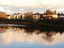
Let’s go back a bit. I started off wondering about the stone marker against the river wall opposite Meath Road. I couldn’t find anything in the Reference Library, couldn’t find anything on the Internet, couldn’t find anyone who knew what it was. So what next?
What next is what I should have done in the first place. I asked in Broadgate News for information. First of all Kath Wallace told me that she’d been told that the stone was there to mark the end of the jurisdiction of Preston Docks.
Then George Cameron remembered ( somehow ) that there had been something in the Lancashire Evening Post back around 1990. He was pretty sure that the article in the paper mentioned that the inscription stood for Eastern Quay Legal Boundary. This ended the limit of Port Dues.
And finally Geoff handed me a print out containing the above photograph together with the following ( and many thanks to everyone for their help ):
This stone marker ( one of two – the other is missing ) marked the eastern boundary ( EB ) of the Legal Quays ( Lc ) of the Port of Preston Customs Area that was set up by the Ribble Navigation Committee in 1844. The way the ‘4’ was represented had yet to be standardized. It was common to see it backwards now and then. There are at least 2 gravestones in Preston churchyards with backward ‘4’s. – Nog Tow.
Friday, 16 April 2010
Subscribe to:
Posts (Atom)