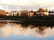
In the last column the solution to the strange stone marker on Broadgate was revealed. It marked the eastern boundary ( EB ) of the Legal Quays ( Lc ) of the Port of Preston Customs Area. So this month I thought I’d knock off the other marker just in front of it and then I could move on to pastures new.
No such luck. One thing leads to another - which in this case is the sound of my head hitting the desk in frustration. However, let’s start with my glass half full and write down what I have found out so far.
At the end of last year I went to the Records Office and found a map dating from the mid 1800’s where a Milestone was clearly marked at the spot where this stone thing is.
So, what is a Milestone. The Romans laid good metalled roads to move soldiers and supplies quickly across their Empire. The Latin for thousand was ‘mille’ and the distance was 1618 yards; the eventual British standard mile was 1760 yards. After Roman times, roads developed to meet local community needs: in 1555, an Act of Parliament made local parishes (or often townships in the North) responsible for their upkeep and boundary markers became important. In 1697, the Justices were ordered to erect guideposts at cross-highways and on the moors. From 1767, mileposts were compulsory on all turnpikes, not only to inform travellers of direction and distances, but to help coaches keep to schedule and for charging for changes of horses at the coaching inns. The distances were also used to calculate postal charges before the uniform postal rate was introduced in 1840. At the height of the turnpike era, there were 20,000 miles of roads with milestones.
That’s pretty clear isn’t it. At the end of Meath Road, on Broadgate, there is a Milestone. If you look on the top you will a distinctive mark. It is called a bench mark and is an Ordnance Survey arrowhead sign found on walls, bridges, churches and specially erected triangulation pillars where the altitude above sea-level has been accurately measured by surveyors. The arrowhead points to a horizontal line above it which marks the exact altitude.
It’s pretty obvious that it marks the distance of one mile from here to the centre of Preston. But does it? I’ve had a look in the centre of Preston and can’t find its counterpart. I’ve walked down Leyland Road to try and find a Milestone there. I can’t find anything. Actually that’s not true. I found a stone marker with FP 66 on it and I’ve no idea what that is.
And that’s where my glass becomes half empty. I’m left with the mystery of when our Milestone was put there, did it measure the distance into Preston, did it measure the distance South across the river over the old bridge or some other route earlier in time before 1759.
Answers gratefully received before it drives me round the bend.
Tuesday, 10 August 2010
Subscribe to:
Posts (Atom)