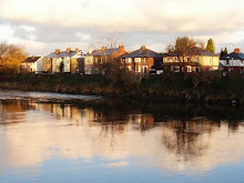
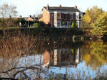
Local residents have been raising concerns about this wall for some time, and now the Environment Agency have commissioned a survey by Arup Consultants Limited, and will be taking action this Autumn to prolong the life of the wall (at least cosmetically), basically by touching up areas of 'spalling', renewing the filler in the movement joints, and repainting the wall.
A local resident raised his concerns with Matthew Connor, from the Environment Agency's Asset Systems Management Division.
He told 'Broadgate is Great':
"I raised my concerns at the meeting on a feedback card about the tree roots that can be seen by anyone walking alongside the wall that are coming from the river side of the wall and poking up through the pavement on the road side of the wall."
"I received a very prompt reply through the post, which was full of details and photographs. It answered not only my question, but the other questions and concerns raised by residents at the meeting, I have to say I was impressed by this level of clarity and accountability, which is not my usual experience of contacting official bodies!".
In the letter Matthew Connor says:
As I stated at the meeting, the structural assessment of the wall carried out by Arup Consultants Ltd, concluded that the wall was structurally stable and could withstand the load put on it if the river reached the level of the top of the wall. However Arup did recommend the following measures to prolong the life of the wall:
- All areas of 'spalled' concrete are to be repaired
- The movement joints are repaired and re-filled with a compressible joint filler
- The wall is painted to prevent further chloride attack/carbonation
These recommendations have now received financial approval for implementation and will be carried out by contractors working for the Environment Agency in Autumn 2008.
At the meeting, concerns were raised regarding tree roots affecting the structural stability of the wall. Due to the wall being supported by piled concrete foundations with reinforcement bars, tree roots were not deemed to be a threat to the wall's stability by Arup.
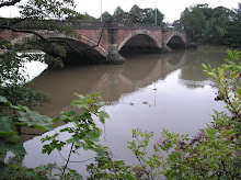
In addition, it was suggested that a 'hole' in the flood defences protecting Broadgate existed at the location of the pipebridge, just upstream of the Penwortham Old Bridge Footbridge that crosses the River Ribble... While it appears lower than the Broadgate wall, it offers the same standard of flood protection, given that the natural elevation of the land is slightly higher on that side of the bridge.
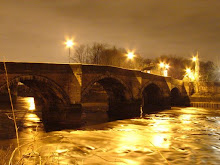
Moving further upstream, (there is) a section of low wall which again is built to the same standard of protection as Broadgate Wall. This is the point at which the 'new' wall protecting the southern end of Broadgate commences...
This new wall is around twenty to thirty years old and was built to a higher standard of protection than the older downstream wall. This was due to the natural elevation of the river bed being higher as you move upstream, meaning that a flood event of a given magnitude would be at a higher level in this location than at the areas downstream protected by the older wall. It is also likely that the observed river levels would have been higher when the new wall was built than when Preston Borough Council constructed the older wall some eighty years ago, due to the effects of climate change and increased development starting to become noticeable. This would have prompted the engineers involved to construct the wall to a higher standard of protection, explaining why it appears that the area around the pipebridge has a lower standard of protection than the area immediately upstream. However, this area has the same standard of protection as the area downstream protected by the Broadgate flood wall.
Whan the Environment Agency replaces the older Broadgate flood wall, we will take into account the latest climate change guidance from Defra relating to sea level rise and river levels. This will ensure that a wall is built to a level sufficient to take into account predicted river level rises in the future.
The letter itself does not say when the older flood wall will be replaced rather than merely repainted, though at the meeting Matthew suggested a timescale of the next 5 - 10 years.
In the meantime do we have any choice other than to accept the reassurances of the Environment Agency and Arup Consultants about the soundness of our flood defences?


2 comments:
Sounds good, but despite this a neighbour of ours whose house fronts the river was telling us his insurance company have now made his property unaffordable to insure because of the flood risk!
Yes, this is good news - and it is important that other measures are taken to make sure our flood risk is minimised, but that these are in line with ALL local, national, and regional strategies to mitigate against flood risk which are concerned with SUSTAINABLE means - which means NO MORE BUILDING ON FLOOD PLAINS OR ALONG RIVER CORRIDORS!
Now we have secured the future of the floodplains on a large section of the Penwortham bank with the designation of the new Ribbleside Country Park, this area will be able to protect our communities for flooding in the long term - but we need to ensure more such areas are protected all along the Ribble - such as the allotments, Penwortham Holme, Fishwick, and so on. It will be interesting to see whether Preston Council accept the recommendations of the new Ribble Catchment Flood Management Plan...
Post a Comment